Wingfield Project
Significant traffic congestion relief whilst connecting national economies and unlocking the regional potential of Cape Town, South Africa.

The Wingfield Interchange is a key strategic freeway junction, with major infrastructure upgrades set to significantly improve traffic flow along the notoriously congested road network of Cape Town. The project will be a catalyst for job creation, skills improvement and economic growth.


The Challenge

Wingfield Interchange is located at the junction of two major national routes, the N1 (Trunk Road 9), running from Cape Town, through Johannesburg to the national border with Zimbabwe, and the N7 (Trunk Road 11), running between Cape Town and the national border with Namibia. The Client considers the Wingfield Project to be a strategic catalyst in implementing their formulated long-term plan for integrating major transport routes in Cape Town.


SMEC was appointed in 2014 to provide professional services in the planning, design, and construction for the upgrade of the existing Wingfield Interchange, including the surrounding road and rail network and associated infrastructure. A key challenge for the project has been navigating the land servitude and relocation of major utility services across the route.


The Solution

The existing interchange is being converted into a 4-level stacked interchange requiring the construction of additional approach viaducts, directional ramps, and collector-distributor lanes. The proposed capacity-improvements to N1 and N7 will necessitate the design and construction of:

  • Ten interchanges (four new and six upgrades)
  • 33 bridges (21 of which will be new)
  • Associated ancillary structures such as retaining walls, culverts, sign gantries and impact barriers
  • Upgrade and relocation of utilities infrastructure including stormwater, electricity, and telecoms
  • New public transport and active transport nodes

Surveys and analysis

SMEC undertook extensive site analysis to inform the road alignment and composition. This included the development of a mesoscopic transport demand model to predict future traffic flow and an innovative survey methodology. The survey data combines a LIDAR survey (4,000 hectares) with mobile laser scanning, stationary terrestrial laser scanning, ground penetrating radar and preliminary geotechnical investigations.


The survey data was instrumental in enabling the creation of a Digital Twin Model, which replicates the site conditions into a federated virtual platform. As well as providing 3D geometries of the road infrastructure and detailed information about the materials used, it can be expanded to include construction schedules and maintenance plans.


Outcomes from the concept design development

Key additions to the Wingfield Interchange will be Frans Conradie Drive and Prestige Drive, two new primary arterial roads that will include space for non-motorised transport, Bus Rapid Transport (BRT) lanes and new stations. New roads have been configured to integrate seamlessly with the future rail network, BRT, and non-motorised transport links.


The proposed highway structures for the Wingfield directional ramps will mainly comprise concrete box girders. Spans will be constructed using the incremental launching method and concrete cast in situ. Bifurcations for the viaducts comprise of cast in-situ prestressed concrete connections.


Various services, including overhead high-voltage power lines and underground cables need to be reconfigured as part of the design. Overhead lines will be replaced with underground cable, while some underground cable will be relocated. SMEC is providing all provisional services associated with the electrical and civil aspects of the services relocation.

6350
m
of bridge structures designed
4000
ha
stormwater management improvements
8
km
planned BRT lanes and associated stations
47
km
new and upgraded Freeway
165
km
high voltage overhead lines relocated underground
20
km
NMT lanes

The Impact

The Wingfield Interchange will play a huge role in connecting Cape Town with the economies of the Northern Cape (Namibia Route) and Gauteng. It is a strategic road junction for the regional transport of goods and services, providing critical economic connectivity between five different regional areas. Key impacts include:

  • A catalyst for job creation, skills improvement, and economic growth
  • Improved safety by replacement of aging infrastructure and mitigation measures at high-risk locations
  • Improved mobility and access along the freeways, which will reduce congestion resulting in significant time savings
  • Seamless interface between two national highways with the local arterial road network
  • Access to the freeways for the previously segregated community of Kensington
  • A catalyst for the development of the Wingfield mixed-use precinct and associated transport-orientated development
  • Integration of public transport systems and a non-motorised transport network, providing safe, accessible transport alternatives

Development of the Digital Twin Model offers countless efficiencies for the client from design through to construction and future maintenance. The model will also enable coordination and clash detection of different utilities or design elements in real-time, aiding collaboration. Additionally, the Digital Twin Model substantially improves communication with stakeholders, through the provision of visualisation tools that simulate construction scenarios and evaluate the impact of different design options or changes.

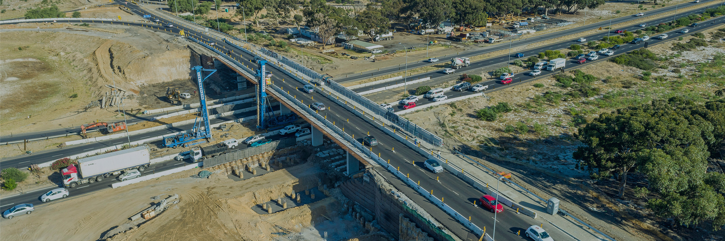
Construction Progress Update – February 2023

Aerial footage showing construction progress of the Plattekloof Road and N7 (Trunk Road 11) carriageway upgrade which forms part of the Wingfield Project (February 2023).

Related
projects

View all

Ready
to
connect?

Talk to one of our specialists about the Wingfield, South Africa project.