Expertise

From the early pioneers on the Snowy Mountains Hydroelectric Scheme, to our leaders and innovators of today, our people make us who we are.
Through our network of global specialists and by collaborating with local partners, we connect you with the best teams and capabilities to deliver highly innovative and sustainable solutions.
As an organisation we are continually evaluating ways we can better provide a safe, flexible, inclusive and respectful workplace for our people and clients.
People are at the heart of our organisation, we strive to create a flexible, diverse and inclusive environment that enables our people to thrive to their fullest potential.
Explore career opportunities
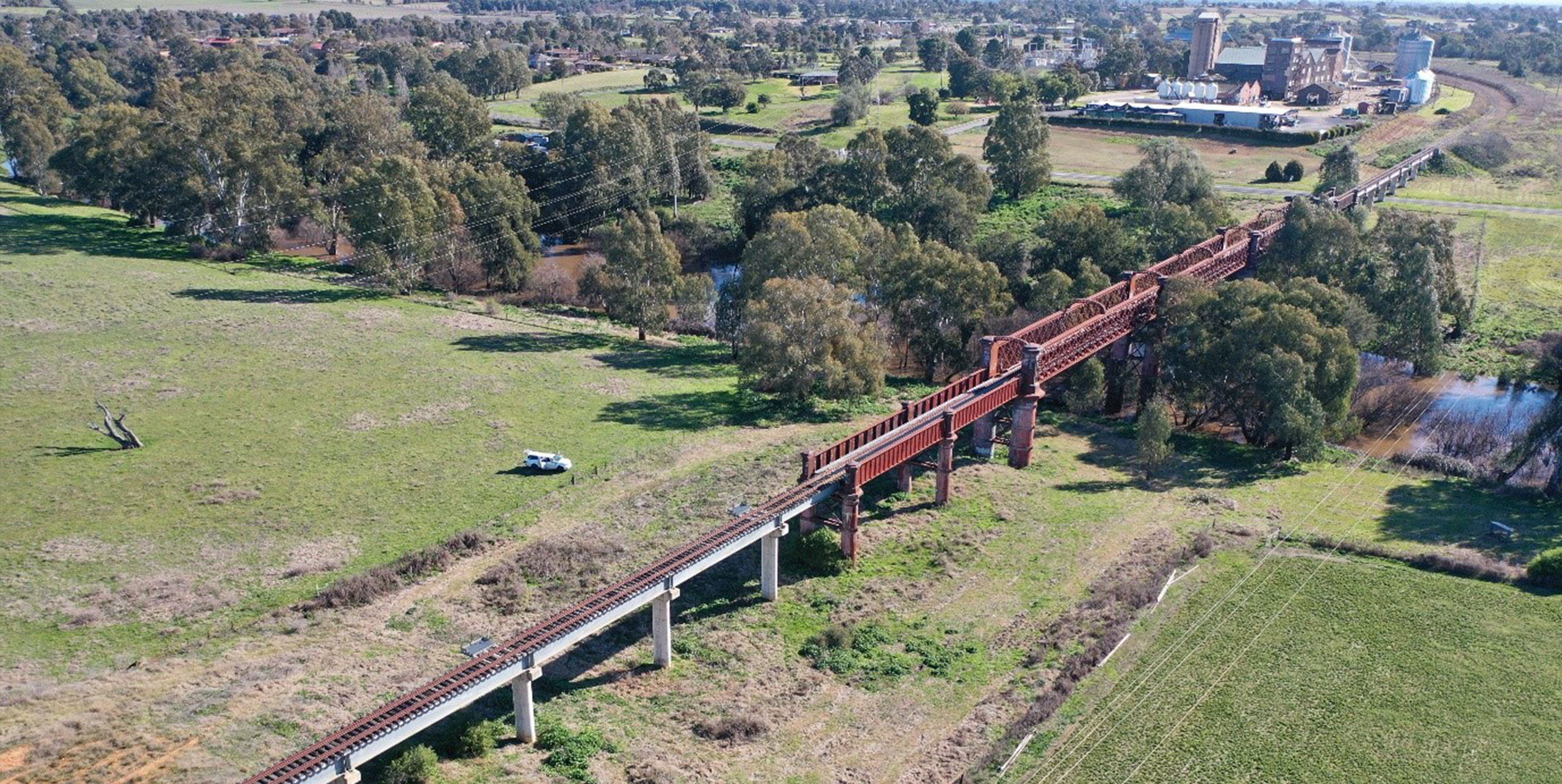
Given Cowra Lines has been out of operation for an extended duration, there was limited information available to assist in informing the concept design development.
SMEC thereby needed to develop a system to obtain a completely new data set to support the reopening of this vital infrastructure.
Developing a data capture system required out of the box thinking due to the scale of the rail alignment and time available; a new innovative way of capturing data was needed.
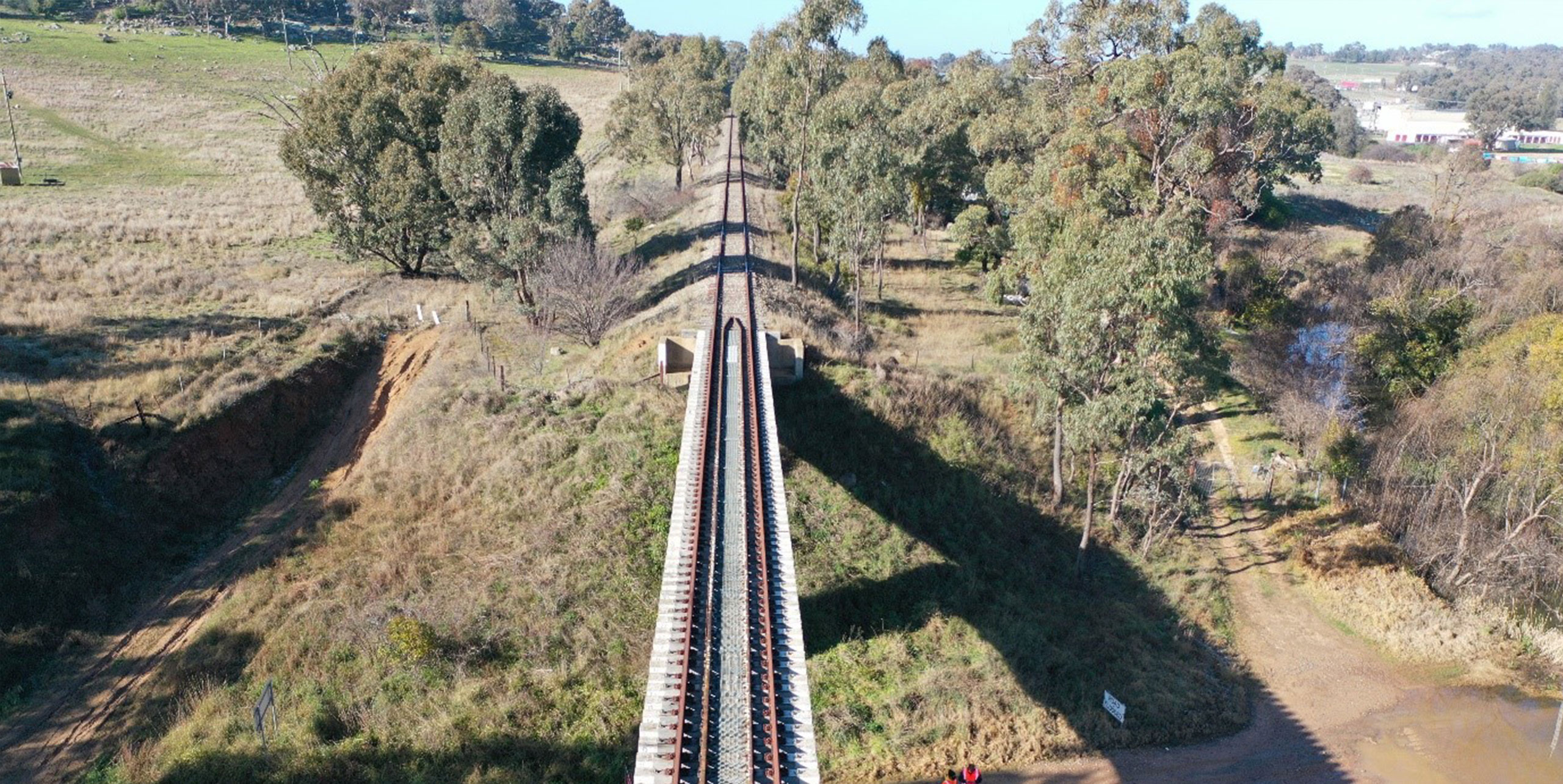
Traditionally projects of this nature commence with a lengthy survey capture program consisting of teams walking the 179km railway line over the course of five to ten weeks, recording their findings with hand-written notes and single frame photography.
Given the timeframe, SMEC proposed an all-inclusive data collection initiative that presented comprehensive information to inform the current and future stages of the design.
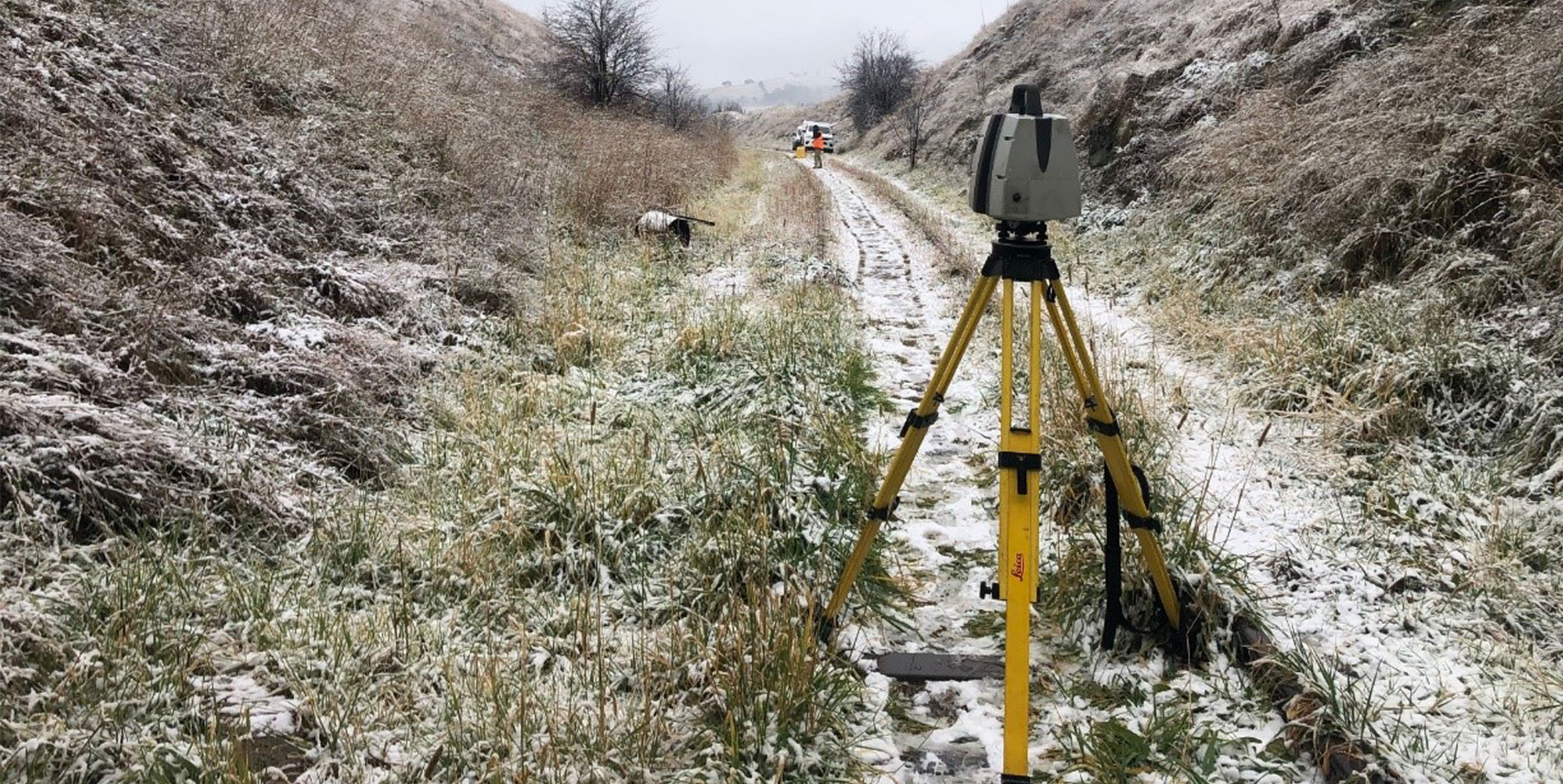
This initiative took only two days and included UAV aerial imagery, fixed wing flight Lidar survey and bespoke in-house Asset Data Collection System (ADCS) to record key items during physical inspections along the entire railway line.
The Asset Data Collection System was built to completely integrate with the client’s asset management system for seamless transition of data and to generate automatic reports based on field data with unique geolocation identities and tagged photographs, easily accessed through a central user interface database.
Alongside the innovative all-inclusive data collection initiative, our teams developed a way to comprehensively capture 360-degree imagery along the 179km line, through the utilisation of 360 GoPro. Auto programmed GoPro that could capture photos at 30 second intervals were attached to the field team and design engineers’ helmets, allowing them to simultaneously capture data during inspections.
The entire length of the line was inspected from 15 June 2021 to 9 August 2021 to obtain documentation of the infrastructure assets. This was performed in five stages:
Our teams physically walked through each element of the rail alignment with auto capture GoPro.
Capturing 360 imagery for every possible feature along the alignment allowed our teams to easily revisit these sites virtually when engineering the respective features to refamiliarise themselves with the constraints and opportunities.
Site visits are a fundamental part of understanding a project on the ground and its associated challenges. For our client and stakeholders walking though the 179km of line was unfeasible, with our approach to data collection and image capturing, a virtual walkthrough of the sites features could be easily conducted.
Undertaking a combination of GoPro auto capture, UAV aerial imagery and fixed wing flight Lidar survey, the supply of information was streamlined. As information was recorded and uploaded daily into the bespoke in-house Asset Data Collection System (ADCS), design tasks and consultation with the client could be undertaken immediately. This allowed closer collaboration and efficient problem-solving with the client. Our design team could talk to the clients immediately about what the team were identifying out in the field; where things were different to expectations, proactively and visually walking the client through any changes.
SMEC’s innovative approach to Cowra Lines sets a new standard in data capture and engineering concept design for Australian projects. One of the unique challenges for infrastructure projects in Australia is our vast and variable landscape, the survey capture program that SMEC implemented uses modern technology in its best form to efficiently, safely and cost effectively provide a solution that delivers an exceptional outcome, improving the experience for clients and partners.
Innovative thinking was demonstrated by our design team with the delivery of comprehensive 360-degree data across the entire 179kms of railway line. The solutions developed minimised community impact and maximised health and safety.
The data collected and the concept design delivered will be crucial in informing discussions on the feasibility of reopening the Cowra Lines. We are proud to be a part of a project which has the potential to support the future growth of Australia’s regional freight network and bring back to service key elements of Australia’s past engineering achievements; enabling current and future generations to thrive.
Inland Rail, Australia’s biggest freight rail transport project in 100 years, was identified as a priority infrastructure project by Infrastructure Australia in 2016.